
Data Collection
Efficient and accurate methods for gathering field data on physical infrastructure.

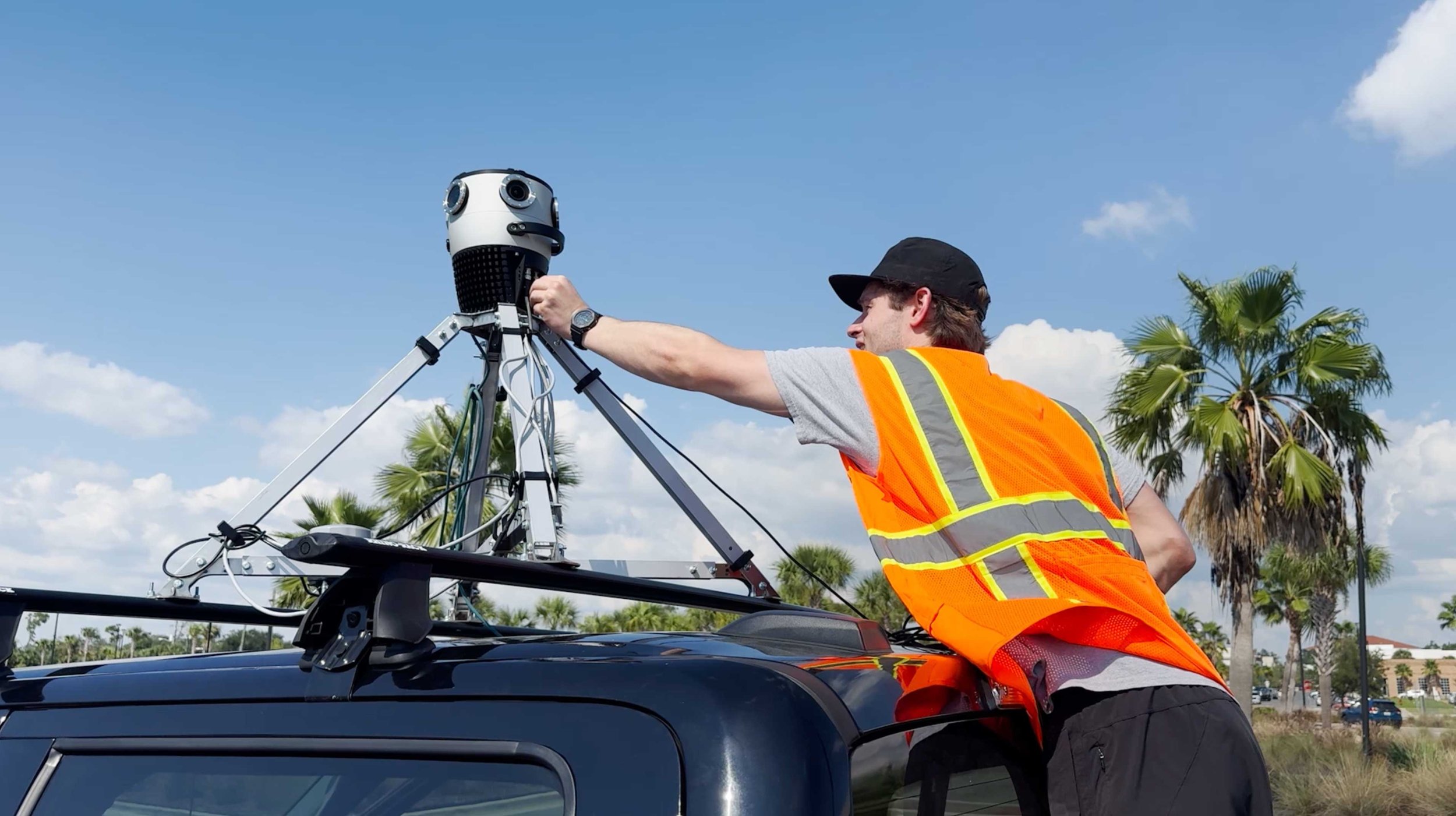
360° Imagery Collection
Using a car-mounted camera, we capture high-resolution 360° images from all angles, ensuring comprehensive coverage. 13.5k resolution imagery, RTK corrected GPS (1-3 cm of accuracy).
Our fielders can also manually collect data using our mobile app, Azmyth on Foot. This imagery is also integrated with RTK corrections.
We offer these services to any customer who needs accurate, efficient data collection for their infrastructure projects.
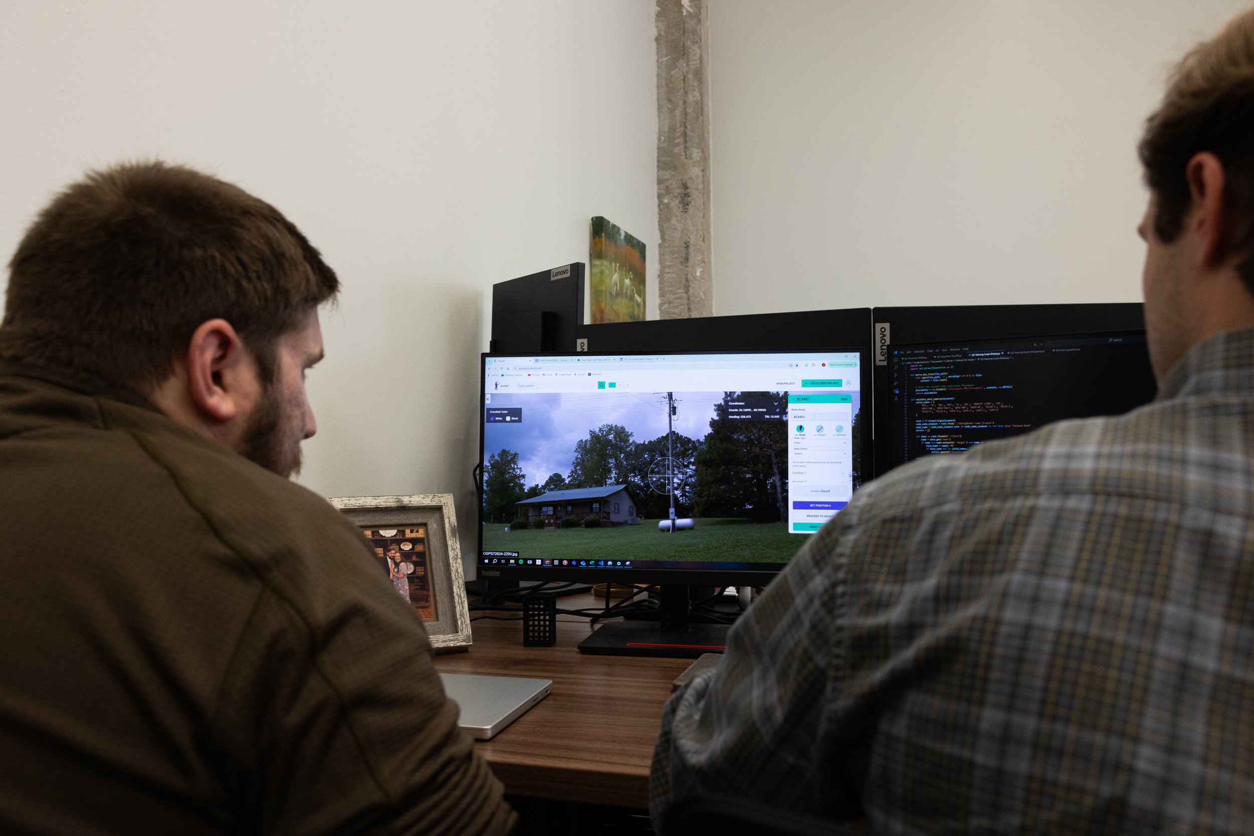
Data Analysis with Azmyth™
Once collected, we can upload the imagery to our platform, Azmyth™.
Azmyth™ allows us to extract data like GPS points, precise measurements, and more. Use cases range from the obvious—power poles—to more niche cases like fire hydrants and buildings. We are adaptable and the choice is yours.
Field data is crucial for grid reliability and network expansion. Traditional fielding methods are time-consuming, expensive, and
error-prone.
Additional Resources

Ready to Elevate Your Field Data?